Mount Muhavura, also known as Mount Muhabura, is one of eight Virunga mountains that stretch across Uganda, Rwanda, and the Democratic Republic of the Congo. It is the third-highest volcano of the eight Virunga massifs and is located in Mgahinga National Park in southwestern Uganda. Mount Muhavura, Mount Sabinyo, and Mount Gahinga comprise the three mountains in Mgahinga National Park. Mount Muhavura is an extinct volcano located in Mgahinga National Park in Uganda and Volcanoes National Park in Rwanda, with Uganda owning the majority of the mountain. Muhabura, also known as Muhavura means “the guide” in Kinyarwanda, and it is thought that the mountain got its name because it is the highest of the three mountains in Mgahinga National Park and can be seen from most parts of Rwanda.
Hiking this mountain is one of the most rewarding experiences because it is one of the highest Virunga volcanoes; conquering it is an accomplishment, but it also provides hikers with great views of the East African region, nature expeditions, and, if you are lucky, sightings of wildlife roaming around their habitat, though this is quite rare.
Mountain Muhabura is more difficult to climb than Mount Karisimbi because it is steeper, but it can be hiked in a single day. It is the most interesting of the Virungas because tourists are rewarded with breathtaking views of the other Volcanoes and the Twin Lakes of Ruhondo and Burera while at the Peak.
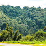
Another intriguing feature of Mount Muhabura is that its Crater Lake is located near its summit, and the vegetation is always drier than in other parts of the Volcanoes National Park. Muhabura is linked to Mount Gahinga by a wide saddle in the west, which has a 40-meter-high Crater Lake at its summit
Hiking Mount Muhabura volcano in Uganda
To hike mount Muhavura, travelers can book permits in advance, though this is not always necessary, or even on the day of the hike. Unlike Mount Sabinyo, which can only be reached from the Ugandan side, Mount Muhabura can be reached from both the Ugandan and Rwandan sides. Hiking Mount Muhabura usually takes 5-6 hours depending on your pace, but it also requires a certain level of fitness.
The hiking process is the same in both countries, and hiking through Mount Muhabura usually takes a full day. It usually begins with tourists determining whether they have the necessary hiking equipment and supplies, which include a packed lunch, snacks, drinking water, hiking boots, long trousers, long-sleeved shirts, and a walking stick to assist them on the slopes, among other things. Tourists must then report to the Park headquarters at the Ntebeko visitor’s center by 7:00 a.m. for a pre-hiking briefing. This briefing includes an explanation of the Mountain’s formation and history, hiking guidelines, tips on how to deal with injuries, and what to expect as you climb to higher elevations.
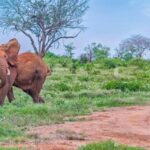
Following the briefing, tourists are driven to the trailhead at the Volcano’s base. The hike is led by armed rangers to protect tourists from wild animals such as elephants and buffaloes, which are frightened by shooting in the air. Before reaching the summit, the hike is divided into two stops, each with a hut.
The first stop is 3116m /10223ft above sea level, followed by 3855m/12648 ft above sea level. The climb’s highest point is 4,127m/13,450ft above sea level. You will be among the first to reach the summit because some hikers stop at the first hut and others at the second.